Helping Local Water Districts Capture Stormwater and Replenish Groundwater on Public Land

At a Glance
For the last couple of years, the Crescenta Valley Water District has been redirecting stormwater runoff to replenish groundwater in the Goss Canyon watershed, providing a cost-effective, nature-based remedy to address long-term water resource challenges facing Crescenta Valley.
As part of these efforts, the District is expanding the creation of stormwater capture projects on parcels of public land within its service area. The District used the Living Infrastructure Field Kit’s runoff contribution data layer to assess potential project sites on public parcels and identify high-opportunity locations for stormwater capture projects. The Field Kit helped the agency move from broad opportunity scanning to site-specific investigation.
“[T]he process of capture, treatment, and reuse of stormwater and dry weather flow…could potentially reduce pollutant load from contaminating the Los Angeles River…”—Crescenta Valley 2025 Urban Water Management Plan
Who
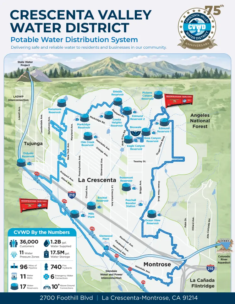
Crescenta Valley Water District is the local government agency that provides water and wastewater services to the Crescenta Valley area of Los Angeles County—an area of about 4 square miles with approximately 36,000 inhabitants.

Objectives
- Identify parcels with strong potential for stormwater capture projects.
- Compare stormwater capture volume among candidate sites.
- Select sites on which to conduct technical feasibility studies.
Process
“It allow[ed] us to identify potential project areas… I used the runoff data, I looked at public lots in our service area… [and] I used the polygon tool to draw around those areas on the map and see what would yield the most runoff.” —Arminé Sargsyan, Senior Water Resources and External Affairs Specialist, Crescenta Valley Water District
Scanning Public Lots for Opportunity: The agency began by looking at public lots within its service area. Because the service area is relatively compact, the team already knew where many public properties were located, including libraries, a sheriff’s station, and utility-owned parcels. The Field Kit’s runoff contribution data helped them figure out which of those sites might have the strongest water capture potential.
Drawing and Comparing Candidate Areas: Staff used the Field Kit’s site selection tool to draw polygons around candidate sites and estimate which areas would yield the most runoff. Using the Field Kit’s site comparison data panels, they were able to compare candidate sites. This allowed them to choose locations for additional evaluation.
Local Groundwater Knowledge: Next, the agency used their own groundwater infiltration data to compliment their work in the Field Kit. They looked at the potential of each candidate site for groundwater recharge potential to further refine their list of sites. Since the conclusion of the project, a groundwater filtration layer has been added to the Field Kit.
“We eliminated certain locations based on an understanding of our groundwater model. Knowing that certain locations, even though they have a high runoff, will not really contribute to our groundwater…The infiltration layer was added on after we had concluded this process, but I'm confident it would have helped in identifying these locations…”—Arminé Sargsyan, Senior Water Resources and External Affairs Specialist, Crescenta Valley Water District
Selecting Sites for Further Study: Based on this process, the agency identified three locations to explore further in a consultant-led technical feasibility study.
Takeaways
- Visualizing data on the Field Kit’s map helped a local water agency identify promising sites for projects.
- The agency also used their own data with the Field Kit’s, showing that the mapping tool can be cross referenced with outside resources.
- The site selection tool supported a practical site assessment workflow by allowing staff to compare candidate sites.
- The agency selected three locations for deeper analysis, showing how the Field Kit can support early-stage project screening, helping to invest resources more effectively.
Sources